


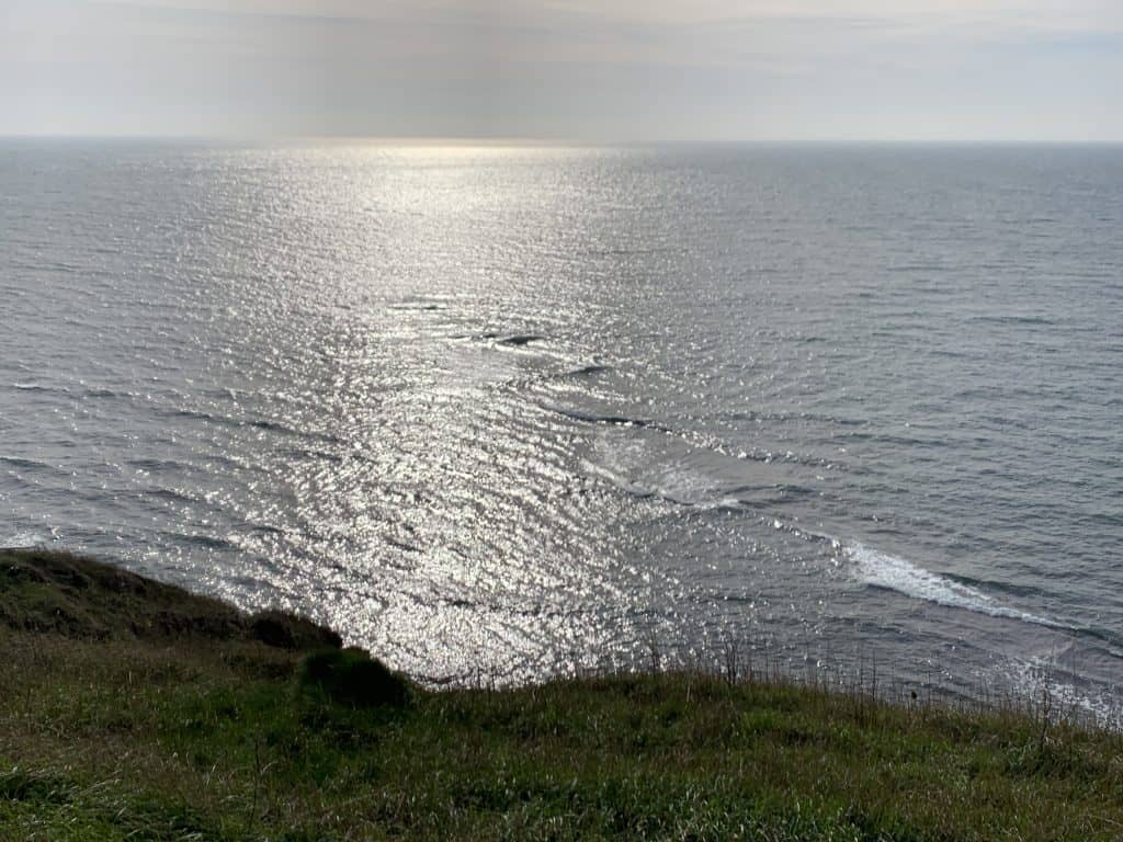
I took this photo from the South West Coast Path in the Isle of Purbeck, Dorset, a few days ago. In it we can see some interesting wave patterns. What causes these?
When waves move from deep water to shallow water they begin to rear up and then break. These waves will be seen at every coastline, but here we see a more intriguing pattern than normal, because the seabed is more interesting than most.
No seabed slides perfectly from shallow to deep water, there are always bumps and anomalies. But look at the chart below (not to be used for navigation!) and you will see that this stretch of coastline is blessed with a much more convoluted underwater landscape than most coasts.
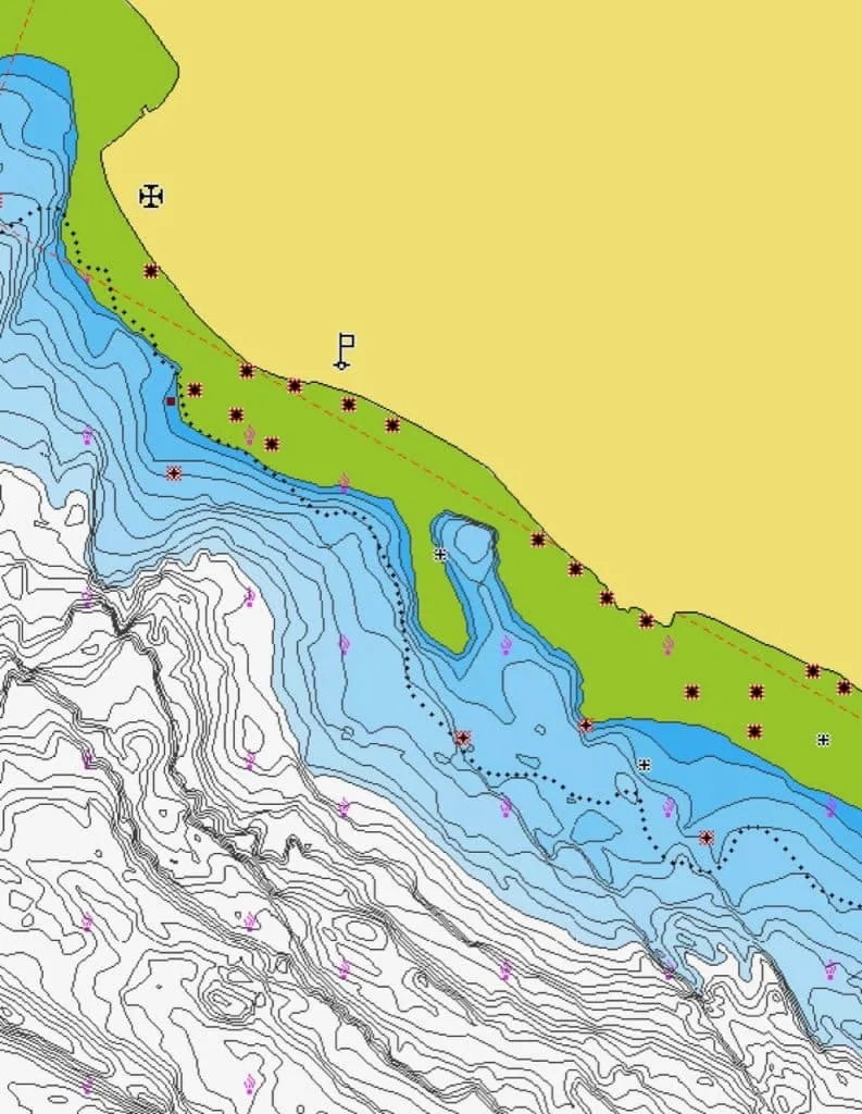
The white areas are deep water, blue areas less deep, green areas are ‘drying heights‘ (sometimes land sometimes sea, depending on state of tide) and the yellow bit is land. The squiggles are depth contour lines.
When the waves encounter the shallow areas they rear up and then break and because we have shallow areas that jut out at an angle into the sea, we see these patterns of breaking waves in the sea too.
The line of breaking waves we can see in the photo are caused by the diagonal shelf of suddenly shallower water that runs from the centre towards the bottom right of the chart.
Look very closely and you’ll also be able to see some waves that have been reflected back out after they have hit the cliffs. These waves interfere with the incoming ones, creating the confused seas we see on the land side of the breaking waves.
For more posts like this see How to Read Water.
You might also like:
The Difference Between Waves and Swell
What are the Six Patterns on this Beach?
Chart from Navionics.