The definition of a drying height:
“The drying height is the vertical distance of the seabed that is exposed by the tide, above the sea water level at the lowest astronomical tide.”
But this is a bit dry. There is a more colourful definition, which is:
Drying heights are the places that don’t know if they are land or sea. They are sea when the tide is very high – eg. at high water springs. And they are land when the tide is very low, eg. at low water springs.
But at all times inbetween they can be wet, dry or inbetween. It just depends how high the land is at that point and the state of the tide.
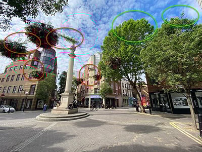
Have a look at this chart:
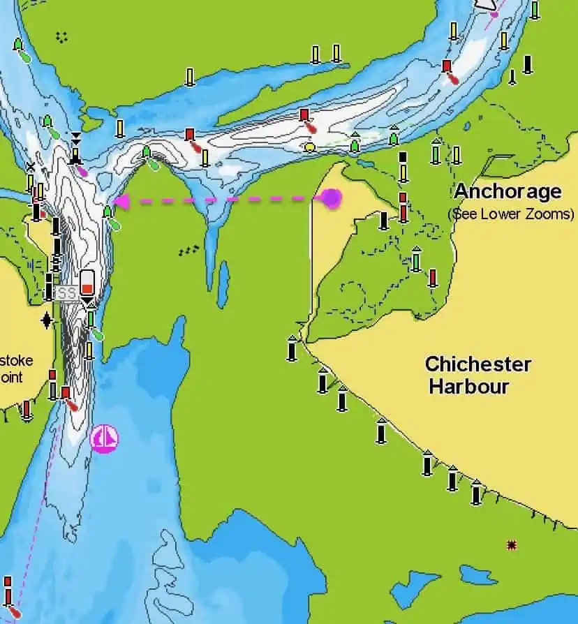
The first thing that will strike you is that the land and sea are marked by more than two main colours. There are actually four:
White = Deep water
Blue: Water (light blue is deeper, dark blue is shallower)
Yellow = Land
Green: These are areas of drying heights. Areas that are sometimes underwater and sometimes not.
(These colours vary according to chart maker, so please check your own chart’s key.)
Imagine you are standing near the small magenta circle in the chart above and looking out to the west – along the line of the dashed magenta arrow.
Notice how the arrow crosses several colours. We are standing on yellow (land), looking over green (drying height), then light blue (shallow water) then green (drying height) then white (deep water) and then yellow again (land).
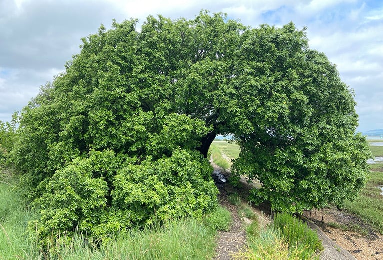
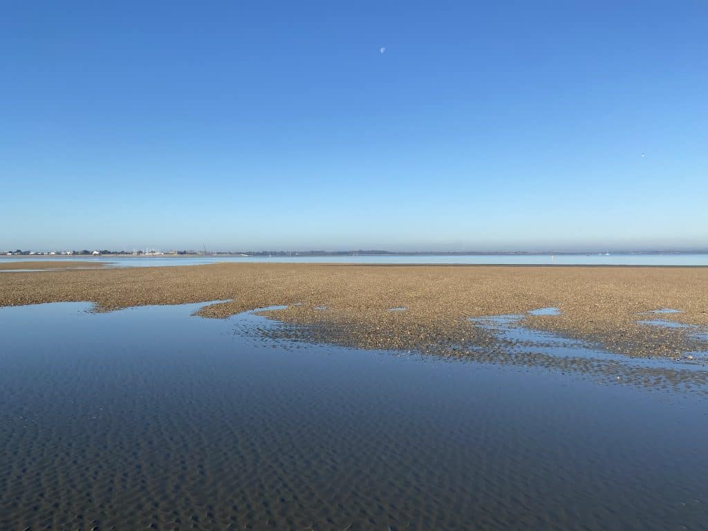
The photo below shows what you would actually see.
You’ll know you’ve grasped what a drying height is when you can answer this question:
What state was the tide in this photo? Answer below.
Correct. We are at low tide. The green areas are currently land because the tide is very low. Come back six hours later and the gravel banks would have disappeared under the sea.
You might also enjoy:
How to Read Wave Patterns at the Coast
How to Read Water – The Book
Chart credit: Navionics