

There are certain clouds that warn that storms are likely.
The shape of clouds is very important. The timing is too.
The general rule is that when clouds grow taller than they are wide, the situation is getting more serious and we need to stay alert.
There are some trends that we can spot over several days that help predict a frontal system and a deteriorating weather picture. And there are a few clues that reveal that storms are very close indeed, minutes away.
In-between the long and short range forecasts, there is one simple and dependable forecast technique that can give several hours’ warning. It is especially helpful in summer.
The key is to look at the shape of clouds early in the day.
Towering cumulus clouds late in the afternoon, especially in summer, does not always indicate trouble, but tall clouds near the start of the day is a strong sign that storms are on the way. You are most likely to spot them over towns, dark woodland or high ground, but they can appear wherever warm air is rising.
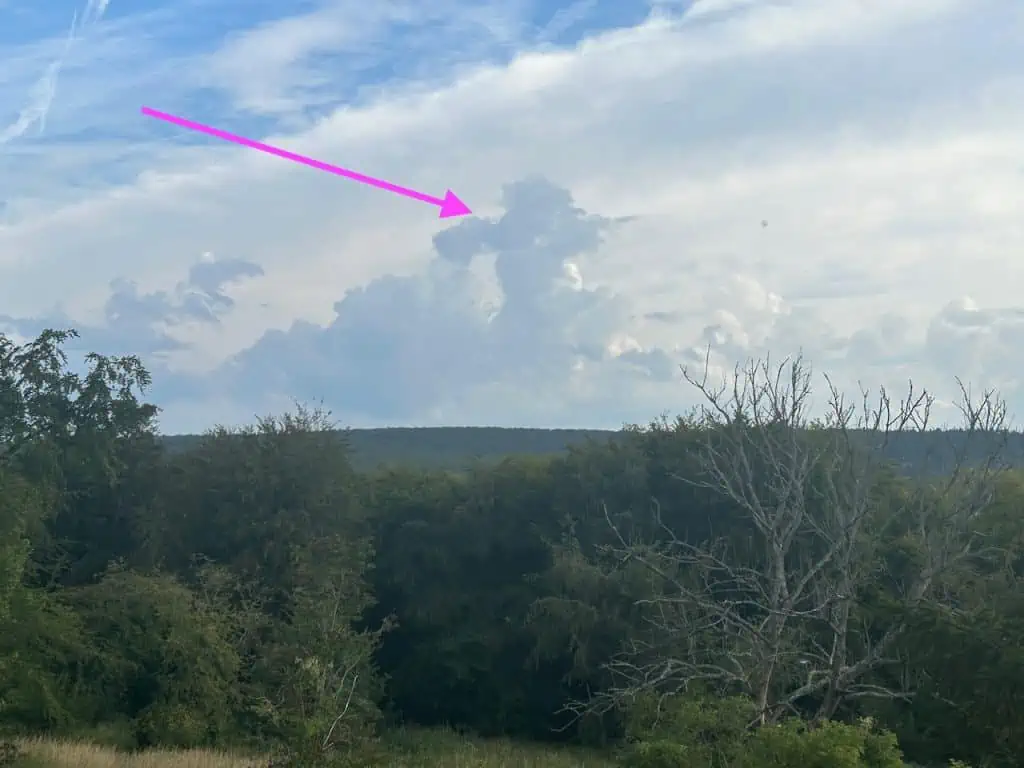
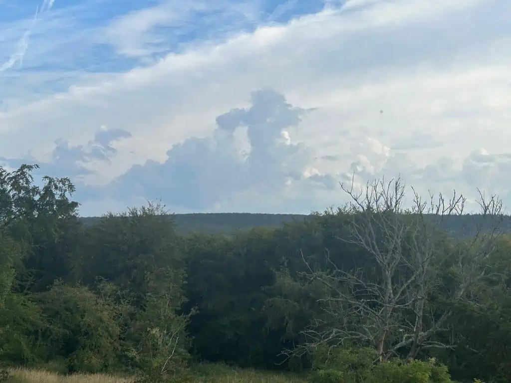
The photo below shows tall cumulus clouds rising up over hills in West Sussex. I took the photo at 8:15am. There was still lots of blue sky and sunshine around.
The storms in the video above arrived only two hours later.
In Summary
Tall clouds always indicate that the air is unstable and that storms are possible. The timing is critical: tall clouds are common late in the afternoon, especially in summer, and not always a concern. It is a more serious situation and a storm warning if we spot them early in the morning.
You might also enjoy:
How to Tell If You are Looking at a Storm Cloud
The Secret World of Weather – The Book
