

There is a simple technique for working out which way a distant storm is heading. Just look for the ‘finger’.
Quick description:
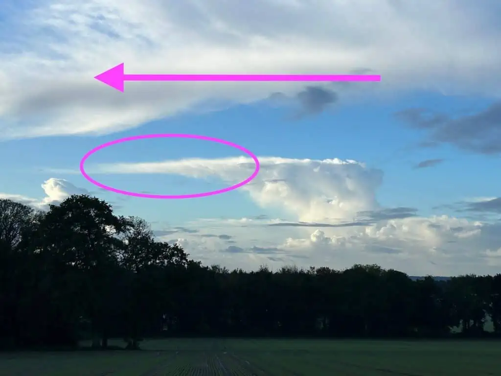
There is a finger of cloud at the top of the storm that points the way the storm is heading.
More background and detail:
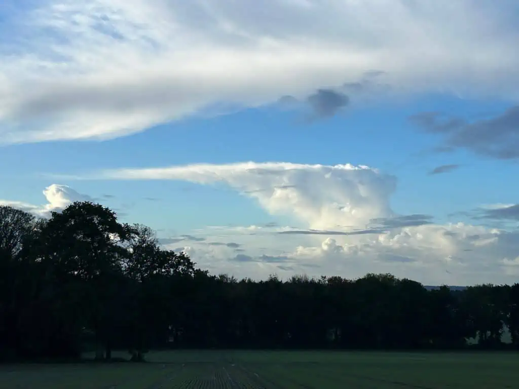
A thunderstorm can form within a cloud called a cumulonimbus. These are very tall clouds that only form when warm, moist and unstable air rises and water vapour condenses. This condensation forms more cloud but it also creates its own heat as it rises (latent heat). This new heat causes more rising and this can lead to a runaway process. The cloud keeps rising until it hits the temperature inversion at a layer called the troposphere. At this level the cloud can’t rise any further and starts to spread out under the invisible layer of cool air that keeps a lid on it.
As the cloud top spreads out it forms a telltale shape known as the ‘anvil’. The shape isn’t symmetrical however and the winds at this high level push and stretch the cloud more in the direction that the winds are blowing. This is the direction that the storm cloud is heading. The finger of cloud at the top indicates the way the storm is heading.
There is more on this in The Secret World of Weather,
“If you look closely at the anvil, you will see that it is not symmetrical: it is shorter on one side and more drawn out on the other. The stretched side is showing you the direction of the winds at that level, and this is the direction that the cloud is traveling. The anvil is a fat finger pointing the way the storm is moving….”
You might also enjoy:
How to Tell if You are Looking at a Storm Cloud
The Secret World of Weather – The Book