


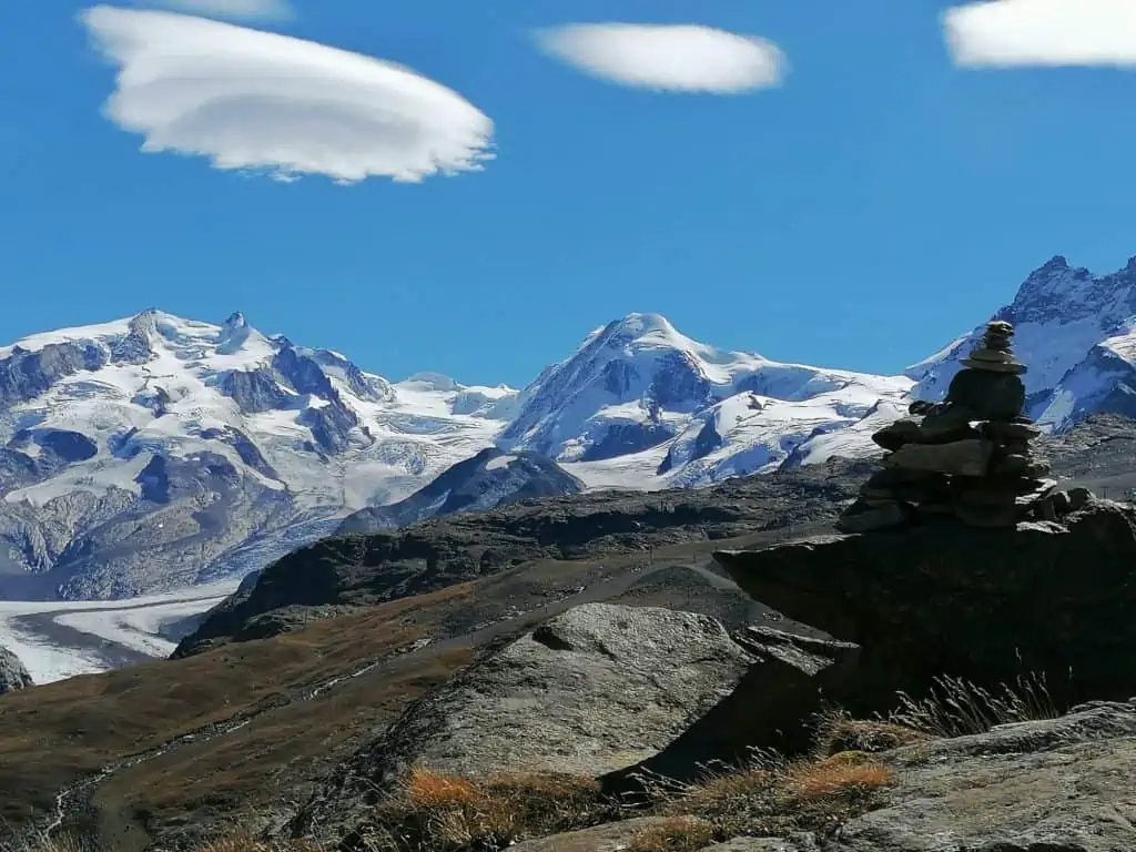
Lens clouds are saucer, lens or lentil-shaped clouds that form when wind blows moist air over mountains.
Their formal name is Altocumulus lenticularis (lenticula means ‘lentil’ in Latin). One of their less formal nicknames is ‘UFO clouds’.
When wind passes over a mountain, some of the air rides over it and then sinks back down on the other side. This creates a rollercoaster effect in the airflow known as a ‘mountain wave’.
At the top of this ride the air cools, water vapour condenses and this causes clouds to form.
The clouds that form map the highest part of the mountain wave. What we are seeing is the curved hump of the top of the air flow.
It is common to see a series of lens clouds in a line. This can mean there is a series of mountain summits below them, but they often form from a single peak.
The air continues in a rollercoaster shape after passing the mountain summit. The flow keeps rising up and then sinking down. This creates the series of lens clouds in a line that runs downwind from the summit.

You might also enjoy:
Why is Visibility so Good in the Mountains?
The Difference between Mist and Fog
The Secret World of Weather – The Book